|
|
Expedition 1: Eye in the Sky
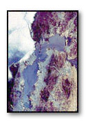
Images of urban areas taken from space give us a new perspective on geography and human activity. In this activity, you interpret images of Tokyo Bay and San Francisco Bay from space and make maps that show key features in these bay areas.
 Begin
this expedition by accessing the images of Tokyo
Bay and San
Francisco Bay from space.
Begin
this expedition by accessing the images of Tokyo
Bay and San
Francisco Bay from space.
When the image you have selected comes full screen, take time to interpret what you are seeing. If possible, use regional maps and/or a print atlas to assist you in identifying key geographic features.
Use the following procedure to construct a map based on the image.
-
In pencil, sketch the outlines of landforms and bodies of water visible in the image.
-
Determine which direction is north and draw a compass rose in the southeast corner of your sketch.
-
Estimate the scale of the map in miles (or kilometers). Add a scale next to your compass rose.
-
Interpret the image. What do you see? Describe as many geographic features as you can, including bodies of water, rivers, mountains, and lakes. Add these features to your map sketch.
-
What evidence of human activity can you find in the image? How are you distinguishing between human-made and natural features? Sketch and label signs of human activity on your map, such as urban parks, bridges, ships, commercial, and residential areas.
After completing your sketch, take time to clean up the map and highlight certain features. Add color and symbols to enhance understanding.
Complete the activity by writing a short narrative describing the image from space. Call attention to some of the features you have labeled on your map and explain their significance.
[ site map | talk to us ]